Arkansaw
Johnson & Press Perkins Graves Old Cottondale & Souther (Earp)
Cemeteries |
Click
Here to go back to the Wise County TXGenWeb Home Page
(Click
Here to go to Listing & Pictures of All Wise County
Headstones)
Arkansaw Johnson Grave |
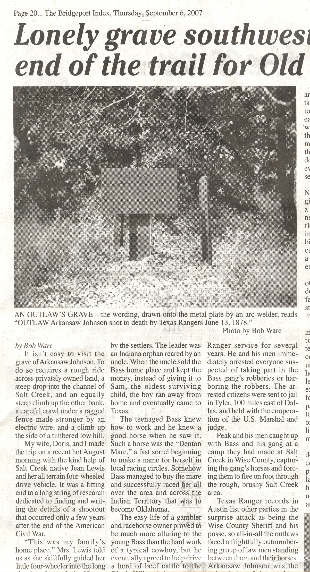
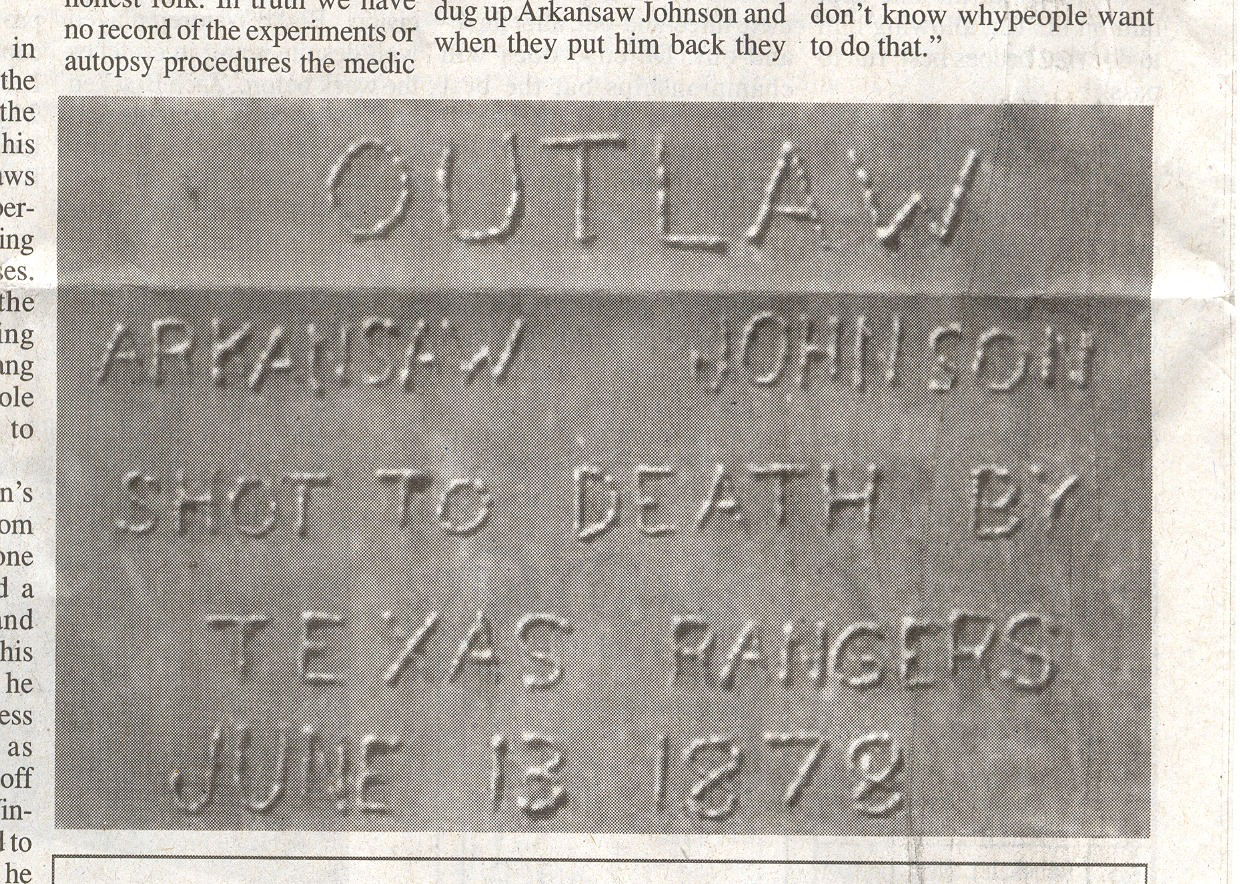
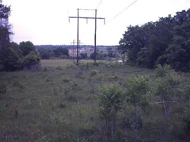
The grave of the outlaw Arkansaw Johnson is located to the west of Cottondale. You go west from Cottondale on Fm Rd 2123, turn left on CR 3673, and then left on CR 3661. Thank you so much to Jean Lewis Raines who drove us across Salt Creek and her pastures and took us up the hill to the grave of Arkansaw Johnson.
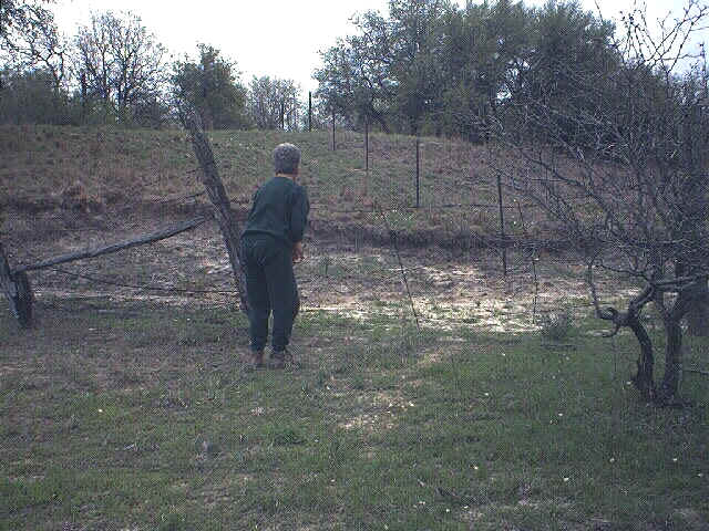
At one time a Boy Scout troop had set a wood marker at the site, but it was burned in a grass fire. The present metal plaque was put up by Curt Holdaway, from Amarillo, when he was doing research for a book.
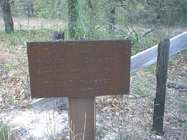
Outlaw
|
From the books: Sam Bass & Gang, by Rick
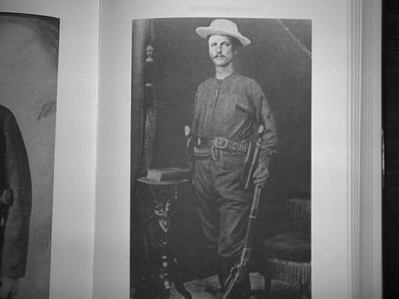
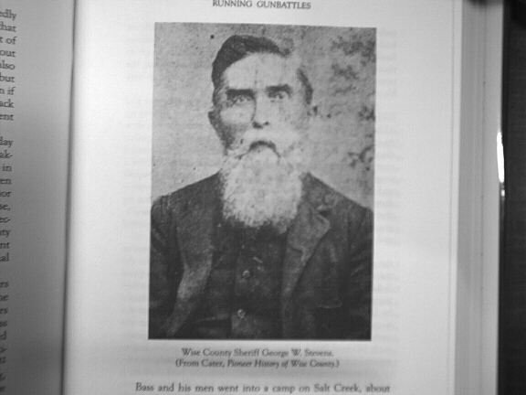
Miller, State House Press, Austin, TX, 1999 & Arkansaw Johnson is thought to have been born in Johnson County, Missouri. He had several aliases but his real name may have been Huckston. After service in the Union Army he engaged in horse stealing and highway robbery in Arkansas. He also robbed the Wilberforce house, killing the man and wife and raping their daughter. In March of 1878 he and a man named Underwood broke out of a jail in Nebraska. They made their way to Texas to join Sam Bass’ gang. The gang had been active in Denton, Wise and surrounding counties stealing horses and robbing trains and banks. On the morning of June 13, 1878 a Texas Ranger named Junius Peak (Picture below) was joined by a posse from Wise County lead by Sheriff George W. Stevens (Picture below). They closed in on the Bass gang at Salt Creek and shot Arkansaw Johnson through the chest as he was saddling his horse. He died instantly and was buried on the spot later that evening. The rest of the gang escaped. At Aurora they bought ammunition, and one told the people in the store "My name is Sam Bass. We just had a battle with the Rangers at Salt Creek. If they come by you tell them that we’re ready for ‘um." Sam Bass was killed within a month at Round Rock. |
A 2007 article from 'The
Bridgeport Index' is below.
These are thumbnails. Click on them to make them large enough to read.
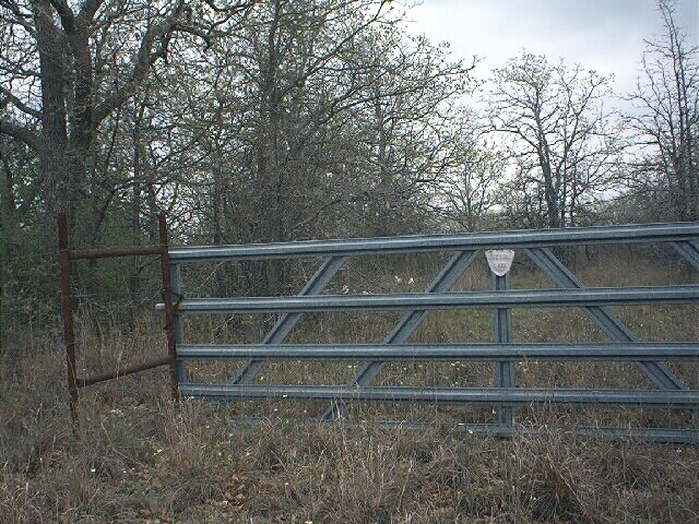
Old Cottondale Cemetery
Old Cottondale Cemetery is located on a hill to the
southwest of the present Cottondale Cemetery. From Fm Rd 2123 at Cottondale turn south on CR 3585.
Take the "T" to the right and go to the first gate on the right.
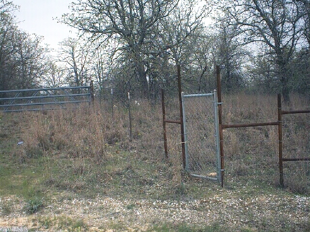
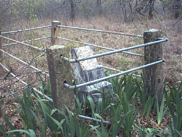
This land was once owned by the Banks family and
most of the graves were moved to the "new" cemetery.
Thank you so much to Jheroen "Jake"
Dorenbosch and Kate Morgan who took us to this cemetery in April of 2001.
It is on a hill out in the pasture to the west of
their house and barn. They have cleaned up the area and put a fence around the
headstones that they originally found in the pasture. When a highline was put in
a few years ago, the crew found two more headstones to the west of the fenced
area. They are numbers 7 and 8 in the data table below.

| # | Name | Born | Date of Death | Information | Link to Headstone Picture |
| 7 | ? broken (Haney, William A.) | Jan 27, 1852 | Nov 4, 1882 | (Click here for PDF sent by Donna Weeden) | Cottondale-Old-7.jpg |
| 4 | Banks, Jabez W. | Feb 28, 1876 | Cottondale-Old-4.jpg | ||
| 4 | Banks, Jabez W. | Additional Picture | Cottondale-Old-4a.jpg | ||
| 4 | Banks, Jabez W. | Additional Picture | Cottondale-Old-4b.jpg | ||
| 4 | Banks, Jabez W. | Additional Picture | Cottondale-Old-4c.jpg | ||
| 1 | Johnson, James P. | Jan 9, 1846 | Sept 24, 1876 | Cottondale-Old-1.jpg | |
| 1 | Johnson, James P. | Additional Picture | Cottondale-Old-1a.jpg | ||
| 1 | Johnson, James P. | Additional Picture | Cottondale-Old-1b.jpg | ||
| 1 | Johnson, James P. | Additional Picture | Cottondale-Old-1c.jpg | ||
| 3 | Keele, Clarica M. | Nov 21, 1821 | Sept 28, 1876 | Wife of J. | Cottondale-Old-3.jpg |
| 3 | Keele, Clarica M. | Additional Picture | Cottondale-Old-3a.jpg | ||
| 3 | Keele, Clarica M. | Additional Picture | Cottondale-Old-3b.jpg | ||
| 5 | McCleskey, William L. | 1878 | Aged 4 y 2 m | Cottondale-Old-5.jpg | |
| 5 | McCleskey, William L. | Additional Picture | Cottondale-Old-5a.jpg | ||
| 5 | McCleskey, William L. | Additional Picture | Cottondale-Old-5b.jpg | ||
| 8 | North, Mary Ida | Apr 20, 1862 | May 15, 1884 | Wife of Jeff | Cottondale-Old-8.jpg |
| 8 | North, Mary Ida | Additional Picture | Cottondale-Old-8a.jpg | ||
| 8 | North, Mary Ida | Additional Picture | Cottondale-Old-8b.jpg | ||
| 8 | North, Mary Ida | Additional Picture | Cottondale-Old-8c.jpg | ||
| 8 | North, Mary Ida | Additional Picture | Cottondale-Old-8d.jpg | ||
| 8 | North, Mary Ida | Additional Picture | Cottondale-Old-8e.jpg | ||
| 2 | Pike, Mary A. | Oct 10, 1834 | Nov 30, 1877 | Born in Coweta Co. GA | Cottondale-Old-2.jpg |
| 2 | Pike, Mary A. | Additional Picture | Cottondale-Old-2a.jpg | ||
| 2 | Pike, Mary A. | Additional Picture | Cottondale-Old-2b.jpg | ||
| 6 | Williams, W.R. | no dates | broken - only "W.R. Willi" showing | Cottondale-Old-6.jpg | |
| 6 | Williams, W.R. | Additional Picture | Cottondale-Old-6a.jpg | ||
| 6 | Williams, W.R. | Additional Picture | Cottondale-Old-6b.jpg |
Souther or Earp Cemetery
Souther or Earp Cemetery is located several miles to
the southwest of Cottondale.
You can go north from the Jacksboro Hwy (199) on
Salt Creek Road, or you can go west from Cottondale and turn left on CR 3673
which becomes CR 3657 or Salt Creek Road. The cemetery gate is on the road just a tenth of a
mile north of Indian Springs Road. You will see a large aluminum gate and a
small walk-through gate. You can see the graves just to the right from the
drive-through gate.
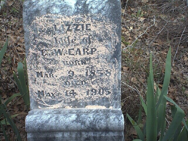
The only headstone we found in April
2001 said:
Lizzie
Wife of
G.W. Earp
Born
Mar 9, 1858
Died
May 14, 1905
There were two rock-covered graves that may be children of Lizzie Earp. There is a George W. Earp (1857-1913) buried in West Bridgeport Cemetery. Also, there are records at the Wise County Heritage Museum of a Civil War Veteran buried here, but we did not find his headstone. The information is:
Franklin Souther
PVT 2nd Co.
Missouri Artillery
Capt. King’s Batt.
1839 - 1870
Email - June 5, 2009 from Jan Mueck <jan.mueck@yahoo.com>
Press Perkins Grave
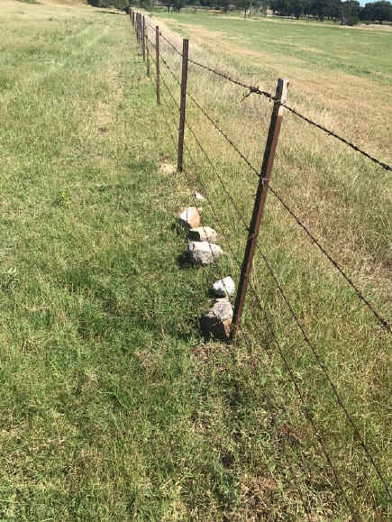
The Perkins Family Cemetery is known to be about 4
miles southwest of Cottondale. There have not been any readable headstones there
in years, but signs of a cemetery are still visible in the pasture. We could not
find any data on who is buried there.
The grave of Press Perkins is suppose to be to the
northeast of Perkins Cemetery, but no marker can be found in the area. He was
killed in one of the Indian raids of the 1860s.
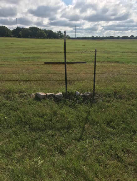
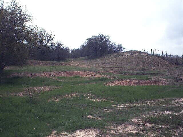
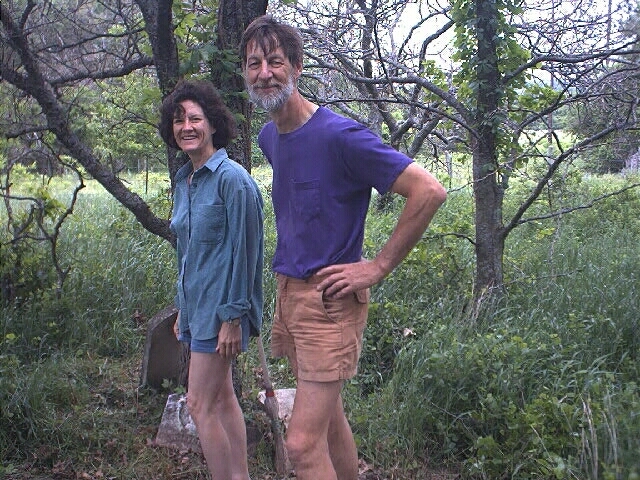
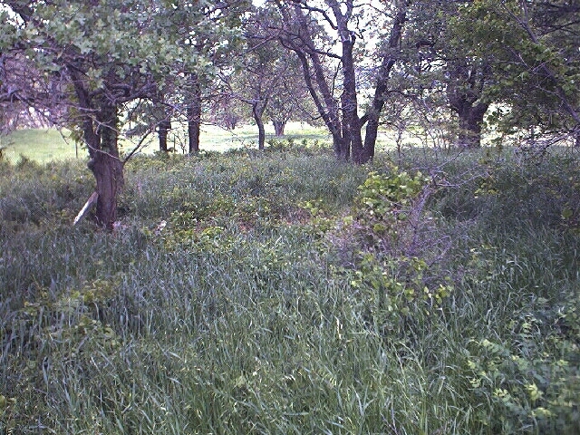
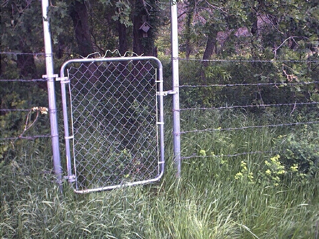
In the summer of 2020 Glenn Gentry took these pictures of the original site of the Press Perkins grave in the fence row on the DIG Ranch. He put the cross in the depressed area where the body had been. There were rocks around that depressed area.
The following is an account of the death of Press Perkins taken from The Pioneer History of Wise County by Cliff D. Cates, Compiled under the auspices of the Wise County Old Settler’s Association, 1907. This book is available at the Wise County Heritage Museum. It has many stories about the Indian attacks in the county with the names of the early settlers involved. In the index of the book you see many of the family names that are still residents of the area.
"Press Perkins met a sad and solitary death. He lived on Salt Creek, about four miles south of the present town of Cottondale; he was married and about 35 years old. The last seen of him in life was when he started out in the morning to round up and bring in the ox-team. The next seen of him he was dead, his body filled with bullets and arrows, on the spot where John Looman and others of Waggoner's cow-hands found him. The Indians were coming into the county on this raid, having passed Galley Stevens' place, where they took a fine mare, with sixty feet of buffalo-hide lariat tied to her neck."